
Description
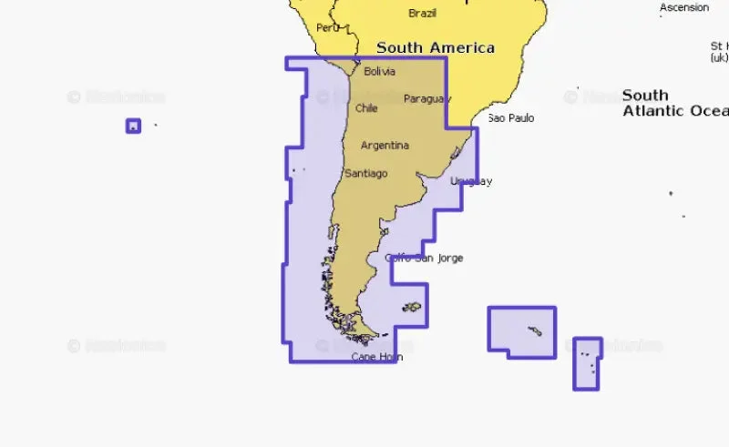
010-C1365-30 Navionics Chile Argentina & Easter Isl.
Explore the stunning maritime landscapes of Chile, Argentina, and Easter Island with the 010-C1365-30 Navionics chart. With comprehensive coverage, this navigational chart allows you to navigate these South American waters with confidence and precision.
Key Features:
- Provides detailed marine cartography for Chile, Argentina, and Easter Island
- Ensures accurate navigation and safe passage through intricate waterways
- Empowers sailors, fishermen, and boaters with essential geographical data
- Compatible with a wide range of chartplotters and navigation devices
Enhance your voyages and fishing expeditions by equipping yourself with the 010-C1365-30 Navionics chart, your indispensable companion for exploring the waters of Chile, Argentina, and Easter Island.


Reviews
There are no reviews yet.